Chandranahan Lake Trek: Explore the Hidden Gem of Himachal
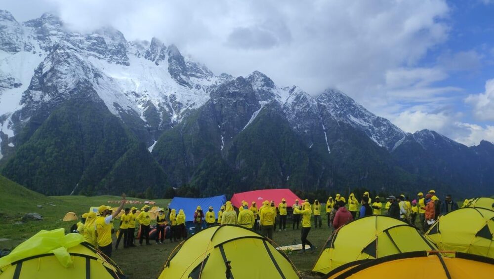
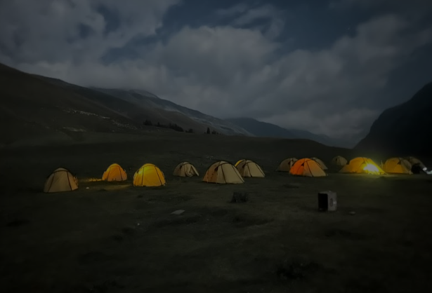
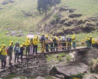
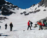
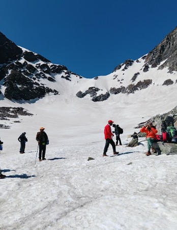
A glacieted strange in remote valleys of the Himachal Pradesh is that many people still have not discovered – Chandranahan Lake. Located in the upper range of the Pabbar valley near Rohru in the Shimla district, the lake lies at a height of around 4000 meters and provides a raw, unspoilt Himalaya experience. For those seeking loneliness, snow-covered roads, ancient alpine views, and a deeply spiritual relationship with nature, Chandrahan Lake Trek offers the trip at all levels. This is not just another trip in the Himachal. Chandranhan Lake has mythological significance; it is believed that it is a sacred place associated with local gods. The lake is also the origin of the Pabar River, which is also an important geographical feature. Whether you are an experienced trekker or a person of great height for the first time, this route offers an ideal mix of adventure, spirituality and natural beauty. Where is Chandrahan Lake? Chandrahan Lake is located in the Rohru area of the Shimla district. The tour begins with Jangalik, which is a bizarre village that acts as a basis for several offbeat Himalaya treks. From Shimla, you can reach the forest by road in about 8 to 10 hours. This journey goes through winding mountain roads and attractive hemeter, which gives a twinkle in the rich Pahdi life. Once in the jungle, before reaching the high height pool, the pugdandi winds have been resident through the lush grasslands, cedar forests and the glacial streams where the Chandranhan lake resides. The road, trackers often camp on Dayara Thach and Lithar Thach, both offer nayabhiram scenes and peaceful camps. What does the Chandrahan Lake Trek do that is special? The trip to Chandrahan Lake is not just about reaching a destination. This is about the gradual landscape, from Jora’s green pastures to rocky lines and icy slopes leading to the lake. The last approach to the lake often requires crossing snow bridges and navigating steep climbs, especially if you pull in early May or June when the ice still reduces high altitude. The lake is a miracle of nature. Surrounded by snow-covered stones, the water reflects the sky in dark blue and brown colors. Often partially frozen, even in summer, Chandranhan looks like a piece of another world. The silence hanging in the air only broke from the air or the sound of melting ice cream creates a meditative atmosphere that is difficult to describe, but impossible to forget. Another unique aspect of this walk is the opportunity to see the Shepherd’s life. Gaddi Hyres often take their flocks to these tall grasslands in the summer. Their easy way of living in the middle of the stiff beauty of the mountain is humble and provides an insight into the permanent human spirit. Best Time Trek for Chandranhan Lake The ideal time for the trip to Chandranhan Lake is from May to early October. In early May and early June you can still find ice on the upper parts, making the trip more challenging, but incredibly beautiful. July and August may bring unexpected monsoon, cause landslides or trail blocking, so many trackers prefer clear weather and stable conditions in early September. Winter drawing is not recommended here until you are an experienced rock climber with a support team and snow equipment, as this area is completely buried under snow. Difficulty level and preparation Chandrahan Lake Trek is classified as moderate to difficult. Height, unexpected weather, and steep classes require a good level of training for hikers. Experience with trekking before high altitude is useful, but is not compulsory if you are physically prepared and ready to give yourself speed. Acclimatization is important. Trekkers should spend sufficient time in the intermediary as a means to avoid altitude disease. Take the right wool, waterproof shoes and trekking equipment. Since the lake is located in a remote area, the facilities are minimal. If you are not part of a guided trek, you can pack the necessary medicines, a good quality tent, and an adequate food supply. Conclusion Chandrahan Lake Trek is more than just a high adventure, this is an intimate journey through pristine landscape, rich cultural traditions, and the raw beauty of the Himalayas. Each step with the footpath, from Dayara’s grasslands to the icy beaches in the glacier lake, gives a glimpse in a world that is largely ignored. Looking for a real relationship with the silence, the challenge, and the nature of hikers, these scars actually provide an unforgettable experience. If you are ready to move beyond the commercial circle and discover the Himachall’s heart, the Chandrahan -Lake is waiting for your footsteps. FAQS What is the height of Chandranhan Lake? Chandrahan Lake is located at an altitude of around 4000 meters above sea level. How difficult is the Chandrahan Lake Trek? The trip is considered difficult to moderate. Trekkers should be in good physical condition and be prepared for steep climbs and high-altitude terrain. What is the best time to visit Chandranhan Lake? The best time for the trip for Chandranhan Lake is from May to early October. Late spring and early fall give the most stable weather and beautiful beauty. Can the first Chandrahan Lake Trek? Yes, you can make early trips with good stamina and the right guidance. However, some previous experience with high altitude trekking is favorable. Is the use of mobile networks under Trek? Mobile signals are usually available in the forest, but the network disappears when you walk high. It is appropriate to inform someone before you go completely offline. Is house or house available? You can find basic houses in the jungle, but beyond this the trip is largely finished with a tent. The directed trek usually consists of clay events.